View full size ↗
It starts with winter cold
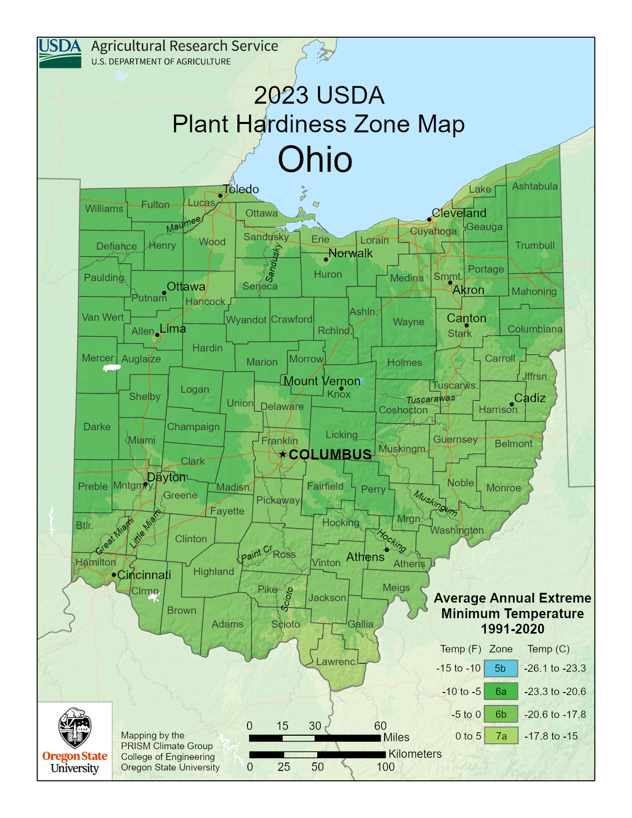
A hardiness zone helps you judge whether a perennial, tree, or shrub can handle winter in your garden. The USDA map uses the average of each year’s coldest temperature from 1991–2020. It isn’t a record low or a forecast for next winter.
Reading the numbers and letters
Zones run from 1, the coldest, to 13, the warmest. Each number covers 10°F, split into a colder “a” half and a warmer “b” half of 5°F each. Ohio’s map includes 5b (−15 to −10°F), 6a (−10 to −5°F), 6b (−5 to 0°F), and 7a (0 to 5°F).
Check your own location
Open the USDA map linked below and search your ZIP code, then check the point where you garden. Use that zone when reading plant labels. A label marked zones 4–8, for example, includes zone 6. Still check the plant’s sunlight, soil, and watering needs.
Your yard has its own little differences
A sheltered wall can be warmer than an exposed corner. Low spots can collect cold air. The map is a useful starting point, but it can’t show every pocket of your yard or tell you the last spring frost date. Bring your questions when you visit.
ONE THING TO REMEMBER
Check your zone before buying plants you want to come back next year.
Keep learning
Want to read a little more? These are the resources behind the guide. Check your plant label and the conditions in your own yard, too.